 Mendenhall Glacier Tours
Mendenhall Glacier Ice Caves in 2026: What Is Actually Left
The Mendenhall Glacier ice caves are gone, and there has not been a reliable one to visit for years. The blue-lit chamber in almost every photograph you have seen was photographed between roughly 2014 and 2019, in a thin, low band of ice at the glacier's terminus that no longer exists. The best-known cave collapsed in July 2014. The ice that produced its successors broke apart during the retreat of the past decade, and on 23 November 2025 the glacier separated from Mendenhall Lake altogether. Pages still selling a bookable ice-cave experience are selling a photograph, not a place. This page sets out what happened and when, why the images keep circulating, and what a visitor who genuinely wants to be on or beside glacier ice can book instead.
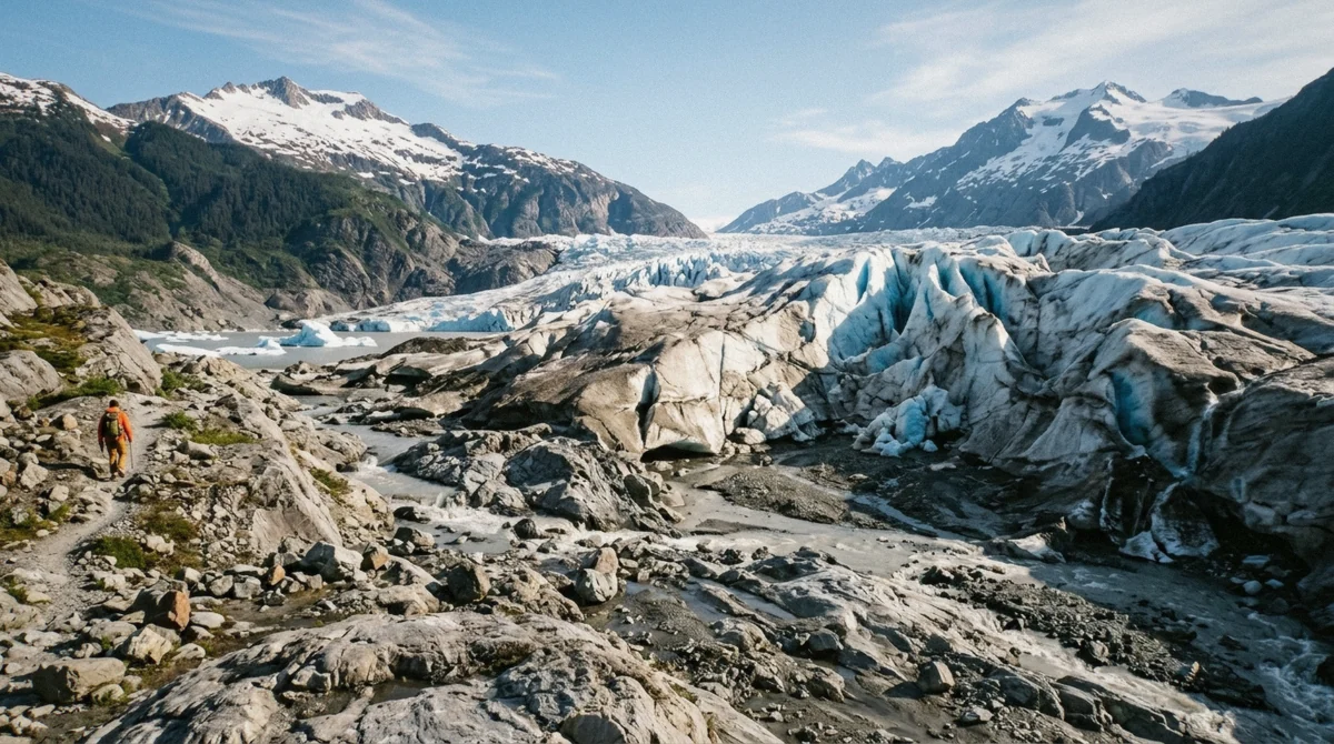
Quick answer Why there is nothing to book, and the three ways to reach glacier ice instead
You cannot visit the Mendenhall ice caves in 2026. The famous cave partially collapsed in July 2014, the smaller caves that formed afterwards were temporary features in thin terminus ice, and that ice broke apart as the glacier retreated out of Mendenhall Lake on 23 November 2025. No operator sells entry to a Mendenhall ice cave, and the photographs that dominate image search were taken years ago. If you want to be on glacier ice, a helicopter landing at $429 includes a guided walk on the surface; if you want to be beside the face, canoe trips cross the lake to it.
Key takeaways
- The headline cave collapsed in July 2014 and the Forest Service reported it as collapsed; later caves were short-lived and are also gone
- On 11 February 2025 the Forest Service warned people away from the glacier face, and a portion of it calved into the lake on 13 February 2025
- The glacier separated from Mendenhall Lake on 23 November 2025, confirmed by glaciologist Jason Amundson and environmental scientist Eran Hood of the University of Alaska Southeast
- The only routine way onto the ice surface today is a helicopter landing with a guided walk, at $429, rather than any tour of a cave that no longer exists
- Do not go looking on foot: the Forest Service logs 10 to 12 search and rescue efforts a year from people leaving the West Glacier Trail, 75 percent of them involving injuries
What Happened to the Mendenhall Ice Caves
The short version: they were never permanent, and the ice that made them has gone.
The caves were meltwater plumbing, not architecture
Glacier caves at Mendenhall formed the way they form everywhere: meltwater found a path under and through the low, thin ice near the terminus, carved a channel, and the channel widened until the roof was thin enough for daylight to come through it in the blue that made the photographs famous. That is a seasonal, self-destroying process. A channel that is wide enough to walk into is by definition close to the point where its ceiling cannot hold, which is why the Forest Service has never treated any Mendenhall cave as a facility, never signed a route to one, and never listed one among the attractions of the recreation area.
The best-known cave partially collapsed in July 2014 and was reported by the Forest Service as collapsed. Smaller caves formed intermittently afterwards, and in 2019 the Forest Service told visitors to understand the risks and recommended going with a guide precisely because the system was changing constantly. That is the last point at which any official body discussed Mendenhall caves as something a person might reasonably go and see.
Then the ice that held them left
The caves lived in the shallowest part of the glacier, the section that floated at and just behind the waterline of Mendenhall Lake. That is also the section that retreated fastest. Between 1998 and 2020 the ice pulled back about 148 feet a year where it terminated in the lake, against about 56 feet a year where it rested on bedrock, roughly two and a half times quicker in the water. The fastest phase ran from 2007 to 2011, at approximately the length of a football field each year.
In February 2025 the process turned violent enough to be newsworthy. On 11 February the Forest Service warned Juneau residents and visitors to keep away from the glacier face after a large crack opened, stating that a substantial portion of the Mendenhall Glacier was expected to collapse at any time. Two days later a portion of the face calved into Mendenhall Lake, and a second warning followed. The thin lake-terminating ice, the part where the caves had formed, broke apart during this phase, and on 23 November 2025 the glacier separated from Mendenhall Lake entirely. Glaciologist Jason Amundson and environmental scientist Eran Hood of the University of Alaska Southeast confirmed the separation; they note that brief seasonal contact may still happen in very wet conditions, but the glacier is no longer functionally a lake-terminating one.
What that means for a visitor is simple. The geometry that produced walk-in caves at Mendenhall does not currently exist, and nobody can tell you when or whether it will again.
What is not known, and will not be claimed here
Two things are worth stating plainly because other pages guess at them. First, there is no published fatality or injury count for the Mendenhall ice caves. No Forest Service source and no news source carries one, so this page does not print a number and you should distrust any page that does. The only quantified safety figure that exists for this area is about off-trail hiking on the West Glacier Trail, and it appears further down.
Second, the current state of any specific cave or void in the ice is not documented by anyone authoritative. That is precisely why this page uses the past tense throughout and does not tell you that a particular cave is open, closed, safe or reachable. The honest position is that the caves of the 2010s are gone, that ice near a retreating terminus is unstable, and that nothing about the present ice has been surveyed and published for public visits.
Why the Photographs Are Still Everywhere
An image pack with no expiry date
Search the phrase and the results fill with the same handful of frames: a lone figure in a red jacket under a rippled blue ceiling, meltwater running over gravel, light coming through ice a metre thick. Those pictures were made in the years around the collapse, when successive short-lived openings kept appearing and photographers went in fast. Image search has no sense of time. A striking photograph from 2016 outranks an accurate paragraph from 2026, gets reposted with a current year attached to it, and reappears on itinerary pages and third-party listings that were never checked against the Forest Service.
The result is a genuine planning trap. Visitors arrive in Juneau expecting a chamber of blue ice within reach of a trail, and find a glacier that has pulled back out of its own lake. The disappointment is avoidable, and avoiding it is most of the value of reading this before you book anything.
| What the photograph shows | When that was true | What is there now |
|---|---|---|
| A large walk-in blue cave with a smooth ceiling | Up to July 2014, when it partially collapsed | Gone. The Forest Service reported the collapse at the time |
| Smaller caves and arches, often shot in winter | Intermittently between 2014 and 2019 | Gone. These were temporary voids in thin terminus ice |
| The ice front standing in Mendenhall Lake with icebergs | Until the separation on 23 November 2025 | The glacier no longer terminates in the lake |
| A guided group walking on a flat white surface | Current, and still bookable | That is a helicopter landing site up on the icefield, not a cave |
Where the caves actually were
They were not near the Visitor Center. Nothing in the paved core of the recreation area, and nothing along Nugget Falls Trail, ever led to a cave; the formations sat in the low ice at the terminus, on the far side from the building, and reaching them meant leaving maintained trail and crossing unstable ground on foot or approaching by water. That is worth knowing because a large share of the questions people ask about this assume the caves were a stop you could add to a two-hour visit. They never were. If you are planning what to actually do with your time on the ground, the walk-by-walk breakdown is in our guide to things to do at Mendenhall Glacier.
The glacier has a long record of uncovering things as it goes. In 2012 retreating ice exposed an ancient forest at Mendenhall, with tree stumps dated to about 2,350 years old at the oldest and 1,400 to 1,200 years old at the youngest. That is the same process that made the caves and then removed them: ice that moves, thins and lets go of what it was holding.
Twelve Years of Mendenhall Ice, in Order
Every entry below comes from a dated Forest Service statement or from reporting on one. Nothing here is projected except the final line, which is labelled as a projection.
-
July 2014
The best-known ice cave collapses
The famous Mendenhall cave partially collapses and the Forest Service reports it as collapsed. It is the end of the single formation that most of the circulating photographs show.
-
2014 to 2019
Short-lived caves keep appearing
New voids open and close in the thin terminus ice from one season to the next. In 2019 the Forest Service tells visitors to know the risks and recommends going with a guide, because the system changes constantly. No route is ever signed or maintained.
-
11 February 2025
Forest Service warns people away from the face
After a large crack appears, the agency warns Juneau residents and visitors to keep away, stating that a substantial portion of the Mendenhall Glacier is expected to collapse at any time. The named danger is large falling ice in the immediate vicinity of the face.
-
13 February 2025
A portion of the face calves into the lake
Two days after the warning, part of the glacier face drops into Mendenhall Lake and a second warning about unsafe conditions follows.
-
23 November 2025
The glacier separates from Mendenhall Lake
For the first time, the ice is no longer in contact with the lake it created in 1929. Glaciologist Jason Amundson and environmental scientist Eran Hood of the University of Alaska Southeast confirm it. The thin lake-terminating ice where the caves once formed is gone.
-
Around 2050
Projected loss of the Visitor Center view
Scientists expect the glacier to retreat out of the view from the Visitor Center around 2050. This is a projection based on measured retreat rates, not a scheduled date, and the reasons it matters to a trip decision are set out in our look at whether a Mendenhall Glacier tour is worth it.
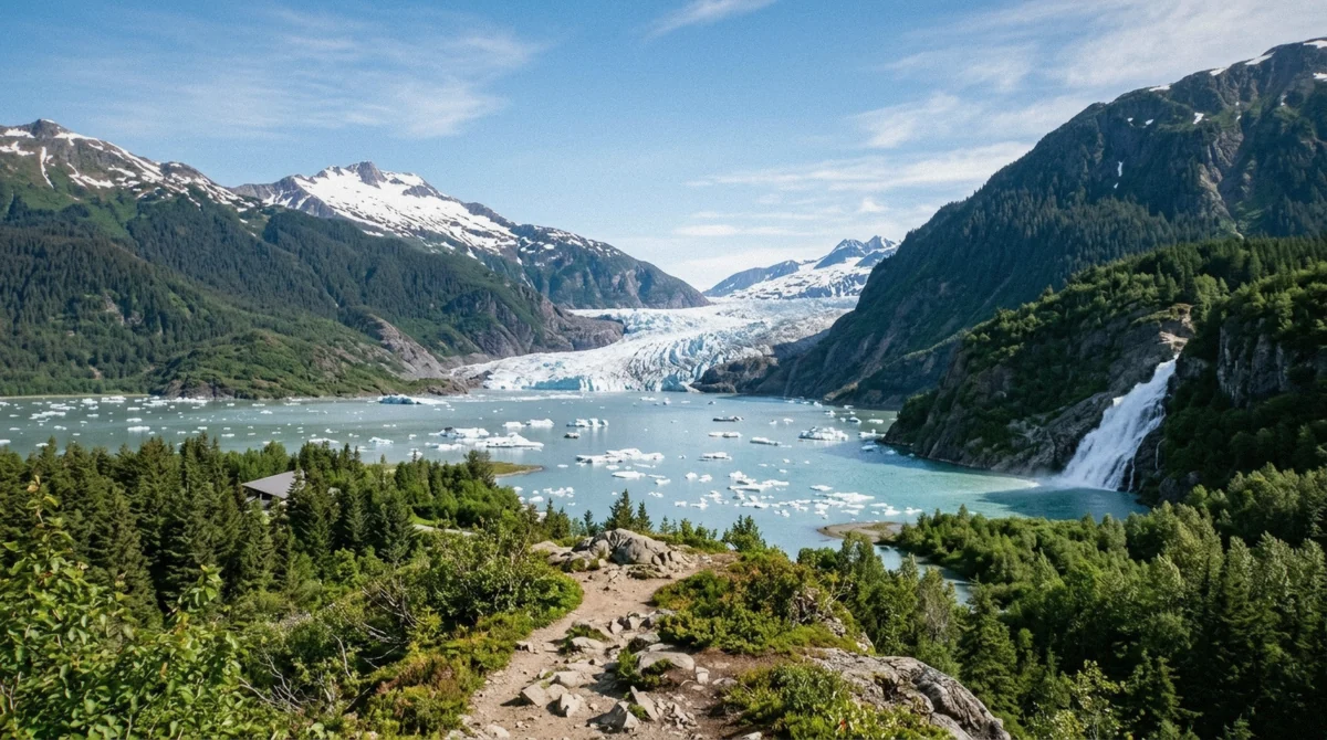
What You Can Book Instead
Three real ways to reach glacier ice out of Juneau, priced and described for what they actually deliver. Prices last verified 2026.
On the ice, beside the ice, or over it
The distinction that matters is whether you want to stand on the glacier or to be close to its face. Those are different products at different prices, and neither of them is a cave.
| Option | Price | What you actually reach | Duration |
|---|---|---|---|
| Helicopter glacier landing with guided ice walk | $429 | The glacier surface itself, up on the icefield, with boots provided | 2.5 hours |
| Canoe across Mendenhall Lake to the face | from $251 | The water among the icebergs and the ground near the ice front | 4 hours |
| Canoe plus guided hike to the glacier face | from $377 | The lake crossing plus a guided walk on the terrain at the face | 4 to 5 hours |
| Seaplane flightseeing over the icefield | from $383 | Five glaciers from the air, no landing | 40 minutes in the air |
The helicopter landing is the only routine way onto the surface
A helicopter glacier landing at $429 flies over the Juneau Icefield, which spans 1,500 square miles and feeds 38 large glaciers, sets down on the ice and runs a guided walk at the landing site. Glacier boots are provided and the cruise-ship transfer is included; the whole thing takes about two and a half hours door to door, which makes it one of the shortest premium options in Juneau relative to what it delivers. What you get is crevasses, meltwater channels and the surface texture of a working glacier. What you do not get is a cave, and no reputable operator will tell you otherwise.
If being on the surface is not the point and being near the ice is, the water route is better value. The Mendenhall Lake canoe tour crosses the lake among the icebergs with a maximum of ten paddlers, provides full rain gear and takes about four hours, with a minimum age of 12. A longer version, the glacier ice adventure canoe and hike, adds a guided walk on the terrain at the face for around $377 and carries a 5.0 rating from more than 1,400 reviews, with transport, rain gear, boots and snacks included. Both are genuinely close-range, weather-exposed days, and both were built around a shoreline that has changed as the ice pulled back, which is one reason the operators reroute rather than publish a fixed landing point.
For a wider view of how these sit against the shuttle and combo tiers, the glacier tours that get you onto the ice are listed alongside every other way to see Mendenhall, and the seasonal picture, including the winter months when the ice is at its most photogenic and the Visitor Center runs reduced hours, is on our best time to visit Mendenhall Glacier page.
Why You Should Not Go Looking on Your Own
The one number that is actually published
People still set out to find ice on foot, usually from the West Glacier Trail, and the Forest Service is unusually direct about how that goes. In its own words, hiking off the West Glacier Trail has resulted in 10 to 12 search and rescue efforts annually, and 75 percent of those rescues involved injuries. The agency warns against trying to get around the rock peninsula, a detour of more than two miles through thick brush and deep rock crevices, and says that reaching the glacier itself requires backcountry experience and several hours round trip.
That figure is about off-trail hiking, not about caves, and it is the only quantified safety statistic in this area that anyone has published. It is enough. The trail itself is 3.5 miles one way, rated moderate to challenging, open year round and with no water available, and it reaches viewpoints rather than the ice. As a walk it is excellent. As a route to a cave it is a rescue statistic waiting to be updated.
Add the February 2025 warnings to that. When the Forest Service says a substantial portion of the glacier is expected to collapse at any time, the hazard it is describing is exactly the hazard of standing under or beside a terminus, which is what entering a cave means. The ice has since pulled back further and the face has moved. Nobody is monitoring it for recreational visits.
So the accurate answer to the question that brought you here is a flat one: the Mendenhall ice caves are not something you can visit, book or plan around in 2026, and the pictures that suggest otherwise are a decade old. That is not a reason to write off the glacier. It is still a 13.6-mile river of ice off an icefield that has been measured continuously since 1942, still walkable to within a lake's width on free trails, and still changing fast enough that what you see this summer is not what the next visitor sees.
Compare the ice-access tours compared against the free walks in our things to do at Mendenhall Glacier guide, and if you are weighing whether any of it justifies the ticket, our honest read on whether a Mendenhall Glacier tour is worth it works through the money.
Questions About the Mendenhall Ice Caves
Can you still visit the Mendenhall Glacier ice caves?
No. The best-known cave partially collapsed in July 2014, later caves were temporary voids in thin terminus ice, and that ice broke apart as the glacier retreated and then separated from Mendenhall Lake on 23 November 2025. No operator sells entry to a Mendenhall ice cave, and no Forest Service source describes one as accessible.
What happened to the Mendenhall ice caves?
Meltwater channels near the terminus opened, were photographed, and closed again, which is the normal life cycle of a glacier cave. The headline cave collapsed in July 2014. The Forest Service warned in February 2025 that a substantial portion of the glacier was expected to collapse at any time, part of the face calved into the lake on 13 February 2025, and the glacier separated from Mendenhall Lake later that year.
Where were the ice caves at Mendenhall Glacier?
In the low, thin ice at the glacier terminus, away from the Visitor Center and not connected to Nugget Falls Trail or any of the paved paths. Reaching them meant leaving maintained trail on foot or approaching over the water, which is why they were never a stop you could add to a short visit.
How do you get inside a glacier in Juneau in 2026?
You do not, as a routine bookable activity. The closest equivalent is a helicopter landing at $429, which sets down on the glacier surface and includes a guided walk with boots provided, so you are on the ice rather than under it. Canoe trips reach the terrain at the face by water for less money.
Why do photographs of Mendenhall ice caves still appear with recent dates?
Image search has no expiry date. Most of the circulating frames were shot between roughly 2014 and 2019, then reposted on itinerary pages and listing sites with a current year attached. Check the date on any page selling a cave experience against the Forest Service record, which has documented collapse and retreat rather than access.
Is it safe to walk on Mendenhall Glacier without a guide?
No. The Forest Service states that hiking off the West Glacier Trail has produced 10 to 12 search and rescue efforts annually, with 75 percent involving injuries, and that reaching the glacier itself takes backcountry experience and several hours round trip. Its February 2025 warnings about large falling ice at the face have not been withdrawn in spirit by anything published since.
How many people have died in the Mendenhall ice caves?
There is no published fatality or injury count for the caves from the Forest Service or from news reporting, so no figure appears on this page and any page printing one is inventing it. The only quantified safety statistic for the area is the West Glacier Trail search and rescue figure above, which is about off-trail hiking.