 Mendenhall Glacier Tours
Mendenhall Glacier Map: Every Stop, Trail and Departure Point
Most any Mendenhall Glacier map shows the trails and stops there. This one pins the trails, the viewpoints, the lake, the campground and the places your day actually begins, which are 13 miles away on the downtown waterfront, and it joins each pin to the trips that reach it. Coordinates were taken from OpenStreetMap through the Overpass API and from the Forest Service's own published figures in 2026. Where a place could not be located in either source it is listed without a pin and labelled as such, because a dot in the wrong part of the valley is worse than an honest gap. If you want the walking detail rather than the geography, that lives on the things to do at Mendenhall Glacier page, and the tours that reach these stops are compared on the homepage.
Quick answer Where everything sits, in one paragraph
Mendenhall Glacier Visitor Center sits at 58.41718 north, 134.54556 west, about 13 miles by road from the downtown Juneau cruise berths. Everything most visitors walk to is within a mile of it: Photo Point, the Steep Creek boardwalk, the Trail of Time and the Nugget Falls Trail all start from the same car park. The whale boats leave from Statter Harbor in Auke Bay, roughly 7 miles away, and the dogsled camps sit on Herbert Glacier, a separate ice body about 10 miles north-west with no road to it at all. That spread is why the map below has focus buttons instead of one fitted view.
Key takeaways
- The valley cluster, the downtown berths and Auke Bay are three separate places on this map: use the focus buttons rather than pinching around
- Capital Transit does not reach the Visitor Center. The nearest stop is Dredge Lake Road, 1.5 miles away on a paved path, which is covered on getting there from the cruise port
- The West Glacier trailhead is on the opposite shore, at the north end of the parking area at the end of Skater's Cabin Road
- Mendenhall Campground has 67 sites on the lake's west side and is the only overnight option inside the recreation area
- Bubble size on the map shows how many trips reach a stop, so you can book a tour to any of these points knowing which ones the industry actually visits
Every Stop, Mapped and Joined to the Tours
Each bubble is a place; its size shows how many of the trips in our catalogue reach it. Click one for the coordinates, the walk, the season and the list of trips that stop there. Type in the filter to narrow both the map and the list below, for example bears, canoe, waterfall, helicopter or free. The satellite base is deliberate: in a glacial valley the shape of the land is the information a street map hides.
The Eighteen Places, and Which Trips Reach Them
Ordered the way you meet them: the building first, then the walks that leave it, then the water and the west shore, then the points outside the valley where the day starts. One entity appears without a pin because it could not be located in OpenStreetMap under its published name.
-
Mendenhall Glacier Visitor Center
8 of the toursThe Forest Service building on the rise above the lake, holding the exhibits, the theatre, flush toilets and the only potable water in the recreation area.
Stops here: Falls + whale guarantee, $199, Falls + whales (Viator), $199, Most-reviewed combo, $249, Double-decker combo, $230, Classic combo, $189, Flexible 5h combo, $199, Trolley, $79, Blue Bus, $83
-
Photo Point Trail
8 of the toursA third of a mile of paving from the Visitor Center down to the open shore of Mendenhall Lake, the one glacier view a wheelchair or a stroller can reach unaided.
Stops here: Falls + whale guarantee, $199, Falls + whales (Viator), $199, Most-reviewed combo, $249, Double-decker combo, $230, Classic combo, $189, Flexible 5h combo, $199, Trolley, $79, Blue Bus, $83
-
Steep Creek bear boardwalk
6 of the toursA quarter-mile paved loop with a raised boardwalk over the salmon creek, positioned a few yards above the water where black bears fish.
Stops here: Falls + whale guarantee, $199, Falls + whales (Viator), $199, Most-reviewed combo, $249, Flexible 5h combo, $199, Trolley, $79, Blue Bus, $83
-
Trail of Time
4 of the toursA 1 mile interpretive loop across ground the ice covered within living memory, paved at the start and gravel where it climbs through the young forest.
Stops here: Falls + whale guarantee, $199, Flexible 5h combo, $199, Trolley, $79, Blue Bus, $83
-
Nugget Falls
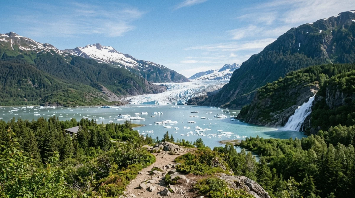
7 of the toursA 377-foot fall in two tiers of 99 and 278 feet, landing on a sandbar at the lake edge within sight of the ice.
Stops here: Falls + whale guarantee, $199, Falls + whales (Viator), $199, Flexible 5h combo, $199, Lake canoe, $251, Ice adventure, $377, Trolley, $79, Blue Bus, $83
-
Nugget Falls Trail
5 of the toursGravel with a low gradient the whole way, branching off halfway along the Photo Point Trail and rebuilt above the high-water line of the lake.
Stops here: Falls + whale guarantee, $199, Falls + whales (Viator), $199, Flexible 5h combo, $199, Trolley, $79, Blue Bus, $83
-
East Glacier Loop
No tourThe climb up the eastern valley wall on gravel, rock and stairs, giving the highest view over the lake basin that anyone reaches on foot in an afternoon.
No guided tour on this site reaches it. Walk it under your own steam.
-
West Glacier Trail
1 of the toursRainforest then bedrock along the far shore toward the ice, 3.5 miles one way, rated moderate to challenging by the Forest Service.
Stops here: Guided trail hike
-
Moraine Ecology Trail
No tourA mile and a half across glacial outwash and forest 25 to 100 years old, most easily picked up from the paved Steep Creek Trail. It carries no map pin here because no way in OpenStreetMap holds that name.
No guided tour reaches it, and it is listed here without a pin because the trail is not mapped under that name.
-
Mendenhall Lake
3 of the toursThe lake the retreating ice built after 1929, and the only surface that carries a visitor toward the face at water level.
Stops here: Lake canoe, $251, Canoe + hike, $377, Ice adventure, $377
-
The glacier itself
4 of the toursThirteen and a half miles of ice draining the Juneau Icefield, which stopped touching the lake in November 2025 and is now walked on only by permitted guided parties.
Stops here: Canoe + hike, $377, Ice adventure, $377, Heli landing, $429, Dogs + ice landing, $839
-
Skater's Cabin Road area
1 of the toursThe quiet west-shore road with a picnic shelter and lake access, whose parking area holds the West Glacier trailhead at its north end.
Stops here: Guided trail hike
-
Mendenhall Campground
No tourSixty-seven Forest Service sites on the lake's west side, reserved through recreation.gov, from $20 a night without hook-ups.
No guided tour stops here. It is a self-drive and reservation-only site.
-
Brotherhood Bridge viewpoint
No tourThe pull-out where Egan Drive crosses the Mendenhall River, giving the free roadside view of the glacier with the whole valley in front of it.
Every coach drives past it and no itinerary stops. You need your own wheels.
-
Statter Harbor, Auke Bay
8 of the toursThe working harbour about 7 miles from the glacier where the whale-watch boats load, and where combination trips spend their hours on the water.
Stops here: Falls + whale guarantee, $199, Falls + whales (Viator), $199, Most-reviewed combo, $249, Double-decker combo, $230, Classic combo, $189, Flexible 5h combo, $199, 3h whales + view, $156, 3h whale watch, $159
-
Goldbelt Tram base, downtown
3 of the toursThe tram building below the cable lines on the downtown waterfront, printed as the meeting point on several glacier tickets.
Stops here: Falls + whale guarantee, $199, Flexible 5h combo, $199, Ice adventure, $377
-
Franklin Dock and the cruise berths
11 of the toursThe downtown berths where the ships tie up, 13 miles from the ice by road and the starting line for nearly every shuttle, trolley and flight transfer.
Stops here: Most-reviewed combo, $249, 3h whales + view, $156, Sea kayak, $161, Trolley, $79, Blue Bus, $83, 3h whale watch, $159, Private yacht, $3,599/group, Heli landing, $429, Dogs + ice landing, $839, Dogsled, $709, Seaplane, $383
-
Herbert Glacier
2 of the toursA separate ice body about 10 miles north-west of the Visitor Center by the verified coordinates, holding the summer dog camps and reached only by helicopter.
Stops here: Dogs + ice landing, $839, Dogsled, $709
How the Valley Is Laid Out
The recreation area covers 5,815 acres, but the part visitors use is a small corner of it, and understanding that corner takes about a minute.
One car park, four trails
Glacier Spur Road ends at the Mendenhall Glacier Visitor Center, and everything on the eastern side of the lake radiates from that one point. Photo Point runs from the front of the building down to the shore. The Nugget Falls Trail branches off it halfway along, which is why there is no separate trailhead for the valley's most-walked path. The Steep Creek boardwalk loops away to the west of the building, over the salmon creek. The Trail of Time climbs south through ground the ice uncovered, and the East Glacier Loop leaves from the same network and works up the eastern wall.
That concentration is the reason a two-hour stop works here and would not work in a bigger park. You never move the car, and the longest walk from it is 0.8 miles.
The west shore is a different trip
Mendenhall Lake separates the two sides, and there is no bridge. To reach the western shore you drive back out of Glacier Spur Road, along Mendenhall Loop Road, and in again on Skater's Cabin Road. What waits there is a picnic shelter, lake access, the campground and the West Glacier trailhead at the north end of the parking area at the end of the road.
Nothing on that side is served by a shuttle, a trolley or a coach. Every trip in the catalogue that goes there is a guided hike with its own van, which is a single listing rather than a category.
What is on this map without a pin
The Moraine Ecology Trail is listed above without a pin. It exists, the Forest Service publishes a page for it, and it runs a mile and a half across outwash plain and forest 25 to 100 years old, but no way in OpenStreetMap carries that name under any spelling, and the nearest verified node is the Junction and Outer Moraine trailhead. Placing it by eye would be a guess dressed as data.
Taku Glacier gets the same treatment and is left off the dataset entirely. It appears in the narration of one flightseeing trip, but the bounding-box queries returned nothing usable for it, so no coordinate for it is published here. Where a coordinate exists, it came from an OpenStreetMap node, way or relation centroid, or from a Forest Service page. Where it does not, the page says so.
The Three Clusters, and Why the Map Has Buttons
The dataset spans about 30 kilometres. Fitted to its own bounds, the part everyone came for renders as a single blob, so the map takes you to each cluster on one click.
The valley cluster
Thirteen of the eighteen places sit within roughly two kilometres of the Visitor Center at 58.41718 north, 134.54556 west. Nugget Falls, the furthest of the walking stops, is 1.2 kilometres away in a straight line and 0.8 miles by trail. Mendenhall Lake fills the middle of the frame, and the ice body's own centroid sits well to the north at 58.50482, since a glacier is a long object and its centre is nowhere near its face.
At zoom 13 the satellite base shows the whole shape of it: the lake, the outwash plain, the moraine ridges on the west side and the two valley walls. That single image explains more about why the trails go where they go than any amount of description.
Downtown Juneau
The berths, the tram base and the transfer pick-ups sit inside about 700 metres of waterfront: the Goldbelt Tram base terminal at 58.29630, Franklin Dock at 58.29367, Dock D and Alaska Steamship Dock E a little to the north-west. At the zoom needed to see the valley, all four collapse into one dot, which is why the downtown button drops you to zoom 15 where they separate properly.
This is also the part of the map with the largest bubble, because nearly every trolley, shuttle, helicopter transfer and whale-watch pick-up in the catalogue starts here rather than at the glacier.
Auke Bay and the far outlier
Statter Harbor sits at 58.38329 north, 134.64983 west, about 7 miles from the glacier by road, and every combination trip that pairs the ice with humpbacks spends its water hours out of it. It is the reason a five-hour combination is not five hours at the glacier.
Herbert Glacier is the outlier that breaks fit-to-bounds on its own. It sits at 58.55750, 134.63380, roughly 10 miles north-west of the Visitor Center by those coordinates, with no road access at all, and every dogsled trip reaches it by helicopter. Leaving it off the map would have been tidier and less honest, since a visitor comparing a dogsled trip to a glacier trip deserves to see that they are two different places.
Distances Between the Points on the Map
Every figure below is either published by the agency named or computed from the verified coordinates, and it says which.
The legs that matter
Two of these catch people out. The 13 miles from the docks is a road distance and not a walk, and the 1.5 miles from the nearest public bus stop is the reason the public-transport option is slower than it looks.
| Leg | Distance | Source |
|---|---|---|
| Franklin Dock to the Visitor Center | 13 miles (21 km) by road | The figure the Forest Service publishes |
| Juneau airport to the Visitor Center | 5 miles | Forest Service |
| Auke Bay ferry terminal to the Visitor Center | 7 miles | Forest Service |
| Dredge Lake Road bus stop to the Visitor Center | 1.5 miles (2.4 km), about 30 minutes on foot | Capital Transit |
| Visitor Center to Nugget Falls | 0.8 miles by trail, 1.2 km in a straight line | Forest Service trail record, plus the verified coordinates |
| Visitor Center to Statter Harbor | About 7 miles by road | Forest Service distance to Auke Bay |
| Visitor Center to Herbert Glacier | About 10 miles, no road | Computed from the verified coordinates |
Why the bus stop matters more than the mileage
Capital Transit buses do not go to the Visitor Center. The nearest stop is at Dredge Lake Road, at the corner of Mendenhall Loop Road and Glacier Spur Road, and from there it is 1.5 miles, about 30 minutes, on a paved and wheelchair-accessible bike path alongside Glacier Spur Road. Route 8 Valley Express is the fastest of the three routes that serve the area, and it runs seven days a week in summer only.
The fare is $2.00 one way for adults, $1.00 for youth aged 6 to 18 and free for children five and under, so a round trip is $4.00 per adult. The agency's own budget for the trip from downtown is up to an hour and a half each way including the walk. That is the honest trade against a ticketed shuttle, and the full comparison of every way out to the valley sits on the getting there from the cruise port page. Last verified: 2026.
Which Trip Covers Which Part of the Map
The join between the pins and the catalogue, drawn from the operators' own published itineraries and checked in 2026.
Coverage by trip
Ground time decides how much of the valley cluster a trip actually reaches. Everything under an hour stays inside the paved half mile.
| Trip | Places on this map it reaches | How it gets there |
|---|---|---|
| Falls + whale guarantee, $199 | Mendenhall Glacier Visitor Center, Photo Point Trail, Steep Creek bear boardwalk, Trail of Time | Narrated bus transfer plus jet boat from Auke Bay Harbor |
| Most-reviewed combo, $249 | Mendenhall Glacier Visitor Center, Photo Point Trail, Steep Creek bear boardwalk, Statter Harbor, Auke Bay | Bus plus custom whale-watching vessel |
| Flexible 5h combo, $199 | Mendenhall Glacier Visitor Center, Photo Point Trail, Steep Creek bear boardwalk, Trail of Time | Bus plus whale-watching vessel |
| Lake canoe, $251 | Nugget Falls, Mendenhall Lake | Van transfer plus guided canoe |
| Trolley, $79 | Mendenhall Glacier Visitor Center, Photo Point Trail, Steep Creek bear boardwalk, Trail of Time | Custom trolley |
| Blue Bus, $83 | Mendenhall Glacier Visitor Center, Photo Point Trail, Steep Creek bear boardwalk, Trail of Time | Ticketed shuttle bus |
| Guided trail hike | West Glacier Trail, Skater's Cabin Road area | Van to the West Glacier trailhead plus guided hike |
The pins no trip reaches
Four places on the map carry no trip at all: the East Glacier Loop, the Moraine Ecology Trail, Mendenhall Campground and the Brotherhood Bridge pull-out. Three of those are simply too long or too far off the standard route for a shared schedule. The fourth, Brotherhood Bridge, is the interesting one, because every coach in Juneau drives over it and none of them stops, which makes the best free view of the glacier a thing only self-drivers ever see.
If your schedule is the constraint rather than your legs, the durations are broken down trip by trip on tour times and schedules, and the flexible five-hour combination and the ticketed shuttle from the terminal are the two that leave the most time on the ground.
Questions About Where Things Are
Where exactly is Mendenhall Glacier?
In the Mendenhall Valley north-west of Juneau, Alaska. The Visitor Center stands at 58.41718 north, 134.54556 west, at the end of Glacier Spur Road, and the ice body itself runs north from the lake with its centroid at 58.50482, 134.51541. The recreation area around it covers 5,815 acres.
How far is Mendenhall Glacier from the cruise port?
About 13 miles, or 21 kilometres, by road from the downtown Juneau berths, which is the figure the Forest Service publishes. A second Forest Service page gives the driving route as 12 miles via Egan Drive, Mendenhall Loop Road and Glacier Spur Road. There is no official drive-time figure, so plan by the distance rather than by a quoted number of minutes.
Which trails start at the Visitor Center?
Photo Point runs from the front of the building to the lakeshore, the Nugget Falls Trail branches off it halfway along, the Steep Creek boardwalk loops to the west of the building, and the Trail of Time and East Glacier Loop climb south and east from the same network. The West Glacier Trail does not: it starts on the opposite shore, at the end of Skater's Cabin Road.
Where do the whale-watch boats leave from?
Statter Harbor in Auke Bay, at 58.38329 north, 134.64983 west, about 7 miles from the glacier by road. Combination trips drive you between the two, which is why the total duration of a glacier-and-whales day is always longer than the sum of its two halves.
Where is Nugget Falls on the map?
At 58.42705 north, 134.53775 west, north-east of the Visitor Center: 1.2 kilometres away in a straight line and 0.8 miles by the trail, which is 2 miles round trip and takes about 1 hour 15 minutes. The falls sit on a sandbar at the lake edge, with the ice face to the west of them.
Why do some places on this map have no pin?
Because their coordinates could not be verified. The Moraine Ecology Trail is published by the Forest Service but carries no matching way in OpenStreetMap, so it is listed without a pin rather than placed by eye. Taku Glacier could not be located either and is left out of the dataset. Everything else here comes from an OpenStreetMap node, way or relation, or from a Forest Service page.
Use the valley button first and let the satellite view do the explaining. Once you can see that the lake sits between the car park and the ice, and that the waterfall is a flat kilometre along the shore rather than a climb, the rest of the planning takes about two minutes.